The GR53 in 3 days: hiking from Wissembourg to Lichtenberg
The GR5 does not cross the Northern Vosges: the GR53 does. Three days and 63 km from Wissembourg to Lichtenberg, stage by stage, with stations and accommodation.

The long-distance trail that crosses the Northern Vosges is not the GR5 but the GR53, waymarked with a red rectangle by the Club vosgien (Vosges Hiking Club). It starts at Wissembourg station (Bas-Rhin) and reaches Lichtenberg in three stages via Obersteinbach and Niederbronn-les-Bains: 63 km of forest, sandstone crags and ruined castles. Here is the route day by day, with the Regional Nature Park’s distances, water and shelter points, and where to sleep.
GR5 or GR53: which trail crosses the Northern Vosges?
The GR5, the “European trail”, enters France through Moselle from Luxembourg and heads south towards Metz and Nancy. It does not pass through Wissembourg, Niederbronn or the Pays de Bitche.
In the Northern Vosges, it is the GR53 that opens the Traversée du Massif des Vosges, the long crossing of the Vosges range. It starts in Wissembourg, on the German border, and joins the GR5 further south, near the Donon (at the Col de l’Engin according to the French Hiking Federation), after just over 160 km.
The Northern Vosges section, described by the Northern Vosges Regional Nature Park, has six stages and 127 km, from Wissembourg to Wangenbourg-Engenthal via Lichtenberg, La Petite-Pierre and Saverne. No stage exceeds 1,100 m of ascent.
There is also a variant, the GR531, waymarked with a blue rectangle: 97 km in five stages from Soultz-sous-Forêts to Saverne, along the foothills. The Park presents it as its multi-day route most easily reached by train.
Day 1: Wissembourg to Obersteinbach
29.1 km, 1,076 m of ascent, 9 hrs 30 of walking according to the Park. This is the longest stage: set off early.
The trail leaves the station and climbs above the Wissembourg vineyards, with a view of the Château Saint-Paul and the Lauter valley. Around the 6th kilometre, the Col du Pigeonnier has shelters and a Club vosgien hut. Further on, the Scherhol tower, built in stone in 1895 on the site of a redoubt of the Lauter lines, serves as a viewpoint.
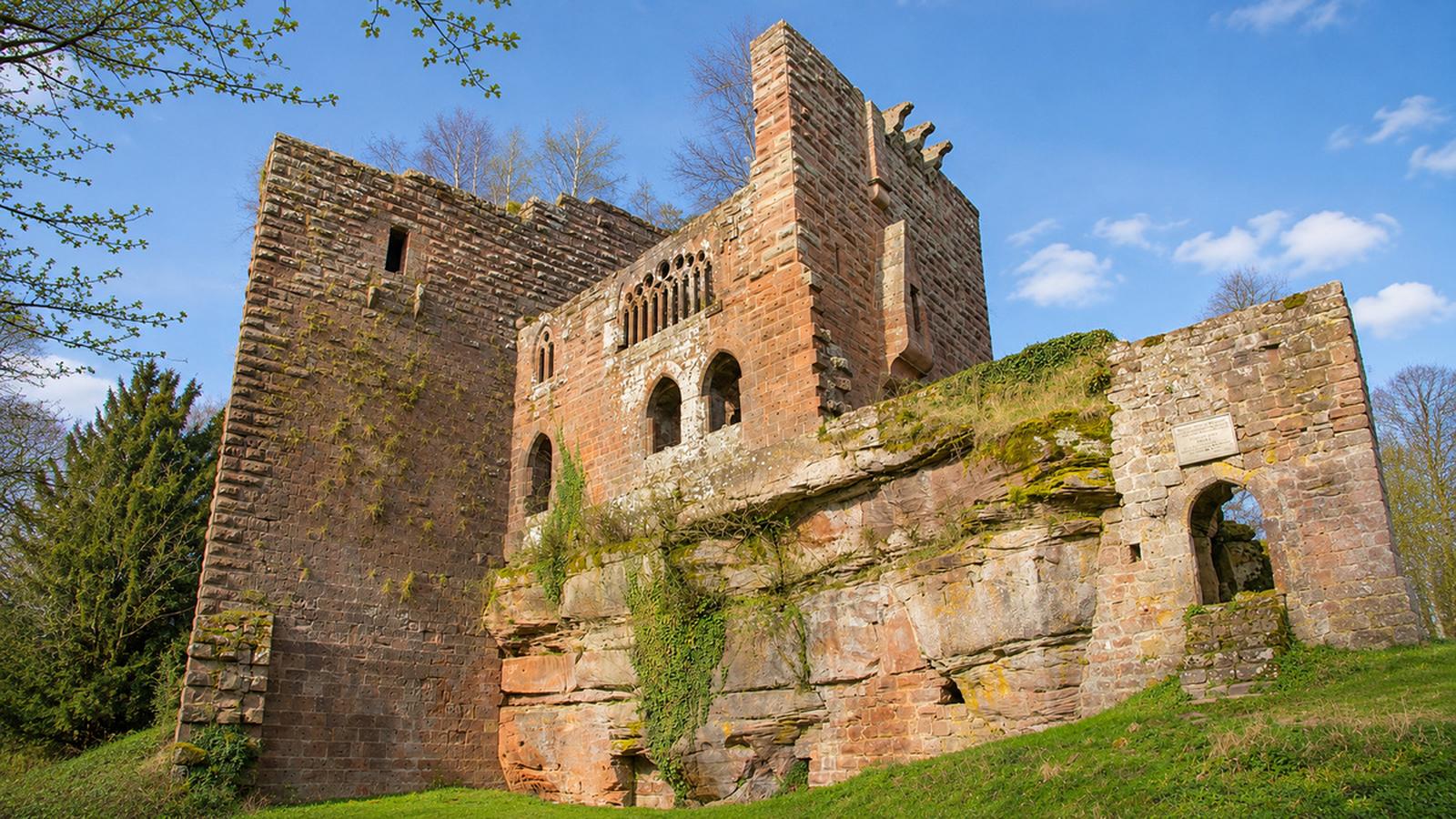
After Climbach (around km 9), the forest takes over: the Rocher des Bohémiens, which holds the remains of a small half-cave castle, the Krappenfels rock, then the string of border castles. The Park points out the ruins of Loewenstein, Hohenbourg, Fleckenstein Castle (admission charged) and Froensbourg. Near Fleckenstein, the charcoal burner’s hut tells the story of the forest’s charcoal burners, free of charge (about twenty minutes).
The stage then descends to Obersteinbach, the small village where it ends.
Day 2: Obersteinbach to Niederbronn-les-Bains
15.4 km, 565 m of ascent, 5 hours on the route updated by the Park in autumn 2026. Older route cards give 18 to 19 km.
South of the village, the Waldi shelter, at the Col du Wittschloessel, was built with the Niederbronn-Reichshoffen branch of the Club vosgien. Around the 6th kilometre, the castle of Vieux Windstein, first mentioned in 1147 and abandoned in 1664 after a fire, still has a section of the rusticated wall of its keep. You then cross Windstein and pass near the old Jaegerthal ironworks, where a first forge was built in 1602; the blast furnace shut down in 1885.
The Heidenkopf rock and its shelter come just before the arrival in Niederbronn-les-Bains, a spa town with a TER regional train station.
My tip: the Alsace Verte tourist office describes this stage over the summit of the Grand Wintersberg (581 m) and its panoramic tower. The route published by the Park runs about 2.5 km further east. If you want the view, allow time for the return trip from Niederbronn, less than 4 km from the summit as the crow flies.
Day 3: Niederbronn-les-Bains to Lichtenberg
18.7 km, 841 m of ascent, 6 hrs 30 according to the Park.
From the 3rd kilometre, Wasenbourg Castle, built around 1275 on a sandstone summit at 410 m, shows off its 4 m-thick shield wall; Louis XIV’s troops destroyed it in 1677. Right next to it, the Wachtfelsen rock bears traces of a Roman-era sanctuary dedicated to Mercury. The Wasenkoepfel tower, the fairy garden and cup-marked stones line the rest of the way.
Around the 9th kilometre, you cross into Moselle at the castle of Grand-Arnsbourg, in the commune of Baerenthal, built in the 12th century and destroyed during the Thirty Years’ War. The stage ends at the foot of Lichtenberg Castle, which the Park counts among the best preserved in Alsace. It is open to visitors.
Four rest stops set up by the Park punctuate these three days: the Halte du Forestier in Wingen, the Halte du Guetteur in Niederbronn, the Halte du Pêcheur in Baerenthal and the Halte du Pontonnier in Lichtenberg.
Another option: Niederbronn – La Petite-Pierre – Saverne
If 29 km on the first day sounds like too much, string together the Park’s stages 3 to 5: Niederbronn-les-Bains – Lichtenberg (18.7 km), Lichtenberg – La Petite-Pierre (17.4 km, 411 m of ascent, 4 hrs 45), then La Petite-Pierre – Saverne (23 km, 570 m of ascent, 6 hours). That makes 59 km, with a station at each end.
Where to sleep on the GR53
- Wissembourg: the starting town, with every type of accommodation.
- Obersteinbach: a few gîtes and holiday rentals, some of which take GR53 hikers for one night. The village’s hikers’ rest house is closed, as the town hall says the building no longer meets safety standards. Book before you set off.
- Niederbronn-les-Bains: the largest town on these three days after Wissembourg; the Alsace Verte tourist office there keeps the list of accommodation.
- Lichtenberg: a small village with few beds. Failing that, Ingwiller station is about 5 km away as the crow flies; the Park waymarks an 18.7 km loop between that station and the castle.
- Bivouac: the Park has set up a bivouac area at the Théodore Monod centre in Erckartswiller, between Lichtenberg and La Petite-Pierre. The unstaffed shelters and huts along the route (Pigeonnier, Hichtenbach, Waldi, Heidenkopf, Col de l’Ungerthal) serve as shelters or rest stops; do not count on a place for the night.
- Luggage: several operators carry bags from one accommodation to the next; the list is on the Park’s hiking website.
Practical information
- Waymarking: red rectangle along the whole GR53, blue rectangle on the GR531.
- Getting there: Wissembourg station (TER Strasbourg–Wissembourg, Deutsche Bahn connection to Mainz); station car park.
- Getting back: stations at Niederbronn-les-Bains (TER Strasbourg–Haguenau–Niederbronn), Ingwiller (TER Strasbourg–Sarreguemines) and Saverne (TER and TGV).
- Seasonal shortcut: a shuttle bus (line 317) links Wissembourg station with Fleckenstein Castle on certain days; check that it is running.
- Maps: IGN 3814 ET and 3714 ET for the three days; the Traversée du Massif des Vosges guidebook is published by the FFRandonnée and the Club vosgien.
- Difficulty: moderate according to the Park, good fitness required. Forest paths are sometimes rocky.
- Water: carry enough for the day and refill your bottles in the villages.
- Opening times and prices for Fleckenstein and Lichtenberg castles: on their official websites.
You will find more walking ideas in the Hiking trails section.
Good to know
Forestry work sometimes disrupts the trail: the Alsace Verte tourist office publishes diversion notices, particularly around Obersteinbach and Grand-Arnsbourg. Check them the day before you set off.
The best period is from May to October; September and October bring the forest’s autumn colours. Huts and inns gradually close from mid-September, and in winter the days are too short for the first stage.
Good to know
Expected crowds this week: usual, busier at the weekend
In the Northern Vosges
- 25 December Christmas Day, public holiday in France (long weekend)
- 26 December St Stephen’s Day (Alsace-Moselle), public holiday in France
- 1 January New Year's Day, public holiday in France (long weekend)
- 20 December – 3 January French school holidays
Back home: the Netherlands
- 25 December Christmas Day
- 26 December St. Stephen's Day
- 19 December – 3 January Christmas Holidays
- 13 February – 21 March Spring Holidays (depending on region)
Getting here
- From Belgium and the Netherlands by car: via Luxembourg and Metz, or via Germany towards Karlsruhe and Wissembourg.
- By train: high-speed trains to Strasbourg (via Paris) or to Karlsruhe (via Germany), then regional trains.
- On site: a car is the easiest way to get around.
Holidays: Nager.Date and OpenHolidays.